Keihoku Course 1: Hiking Kyoto Circuit Trail
About an hour from Kyoto City is the Keihoku. Although technically still part of Kyoto City, Keihoku is quite remote place surrounded by beautiful forest. It is not surprising then, that this forested region is where you can find the Keihoku Course– a 40km section of the Kyoto Circuit Trail. While the Keihoku Course is easily the most remote section of the Kyoto Circuit Trail, it is that very reason that makes it all the more beautiful. If you are aiming to get away from the crowds and tourists traps in Kyoto, you wont be let down.
Note: See here for the other entries of our Kyoto Isshu Trail (Kyoto Circuit Trail) series.
Kyoto Circuit Trail: Keihoku Course
Hosonoguchi – Takimatanotaki Waterfall
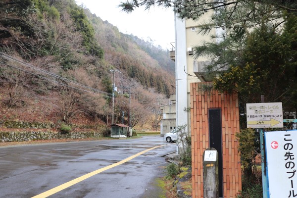
To get to the beginning of the trail take a bus from Kyoto Station bound for Shuzan. In about an hour, we arrived at the Hosonoguchi bus stop. Bus service is quite limited, so make sure to check bus schedule before you leave!
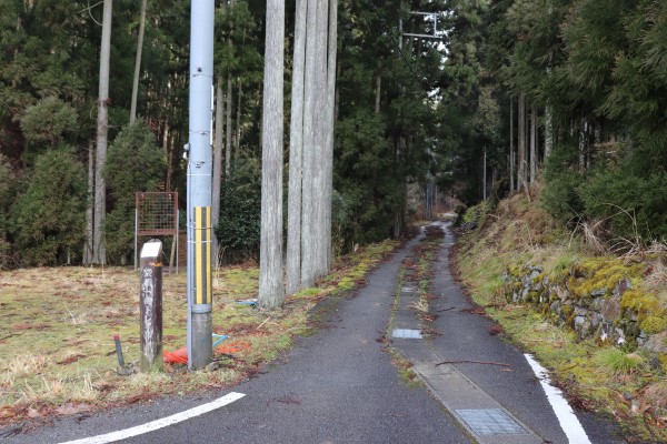
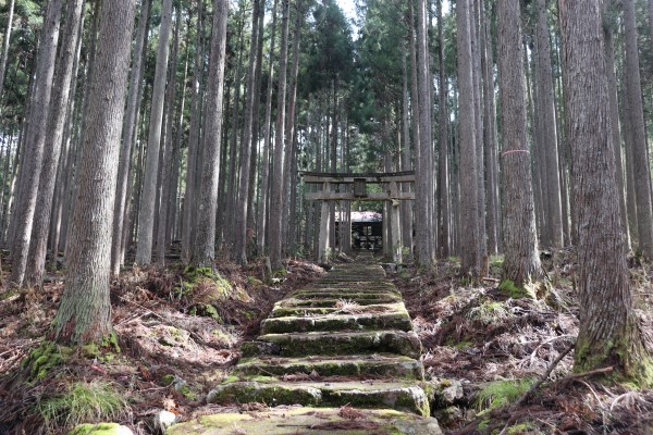
From the Hosonoguchi bus stop, walk for 10 minutes to the former Hosonoguchi Elementary School.
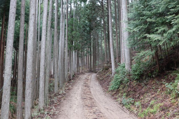
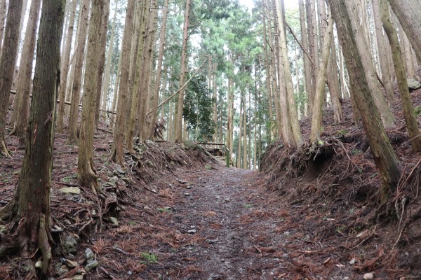
The trail is right next to the old school building. Before long, the trail goes into the mountain and heads to the Takimatanotaki Waterfall.
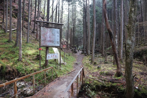
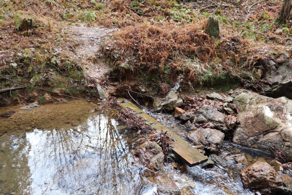
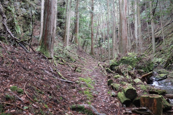
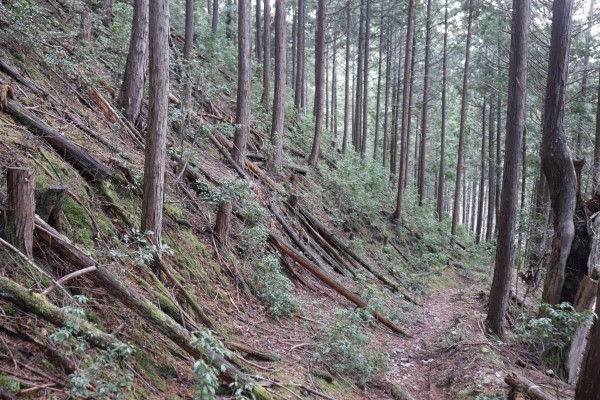
The path around here is a little bit rough. We had to cross a little stream, but the bridge is sometimes broken or really slippery. Maybe Keihoku Trail is overall a bit rougher than the other Kyoto Circuit trails.
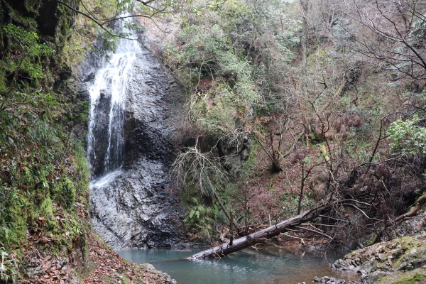
After roughly 30 minutes from the school, we arrived at the Takimatanotaki Waterfall. This waterfall was allegedly named by the nephew of Oda Nobunaga. The waterfall is 20m long. It is very big and indeed, very pretty. It is quite surprising there is such a pretty waterfall in the middle of the forest like this.
Takimatanotaki Waterfall – Chanomi-toge Pass
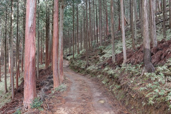
After the waterfall, the trail will brought us into a Kitayama cedar forest. The Kitayama cedar tree is Kyoto’s prefectural tree. They are historically used in teahouses and many other traditional buildings in Kyoto. While the trees are mainly cultivated in Nakagawa, located a few miles south, they are also common in Keihoku.
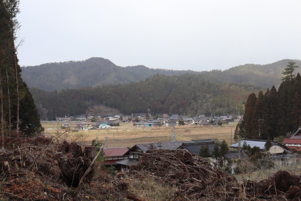
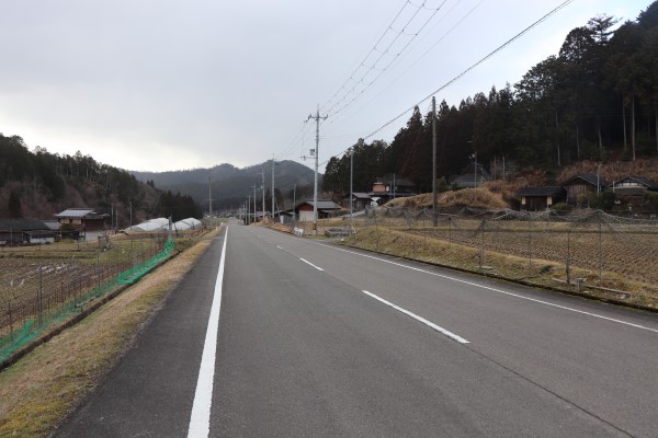
After a while, the trail goes through the little community of Yono.
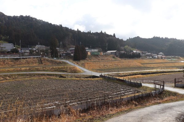
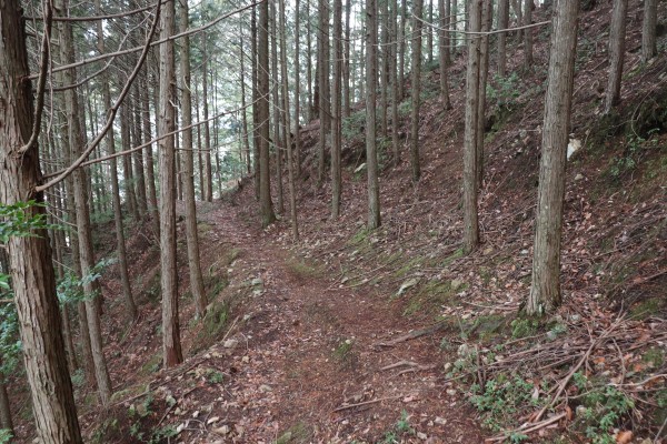
Once we walked through Yono, the trail goes back in to the mountains. Up to this point, the trail is rather straightforward, but it gets a little bit complicated around here as there are several side routes. On the bright side, there are many signs for the trail around here, so if you can’t find any after a few minutes, you may be going the wrong way!
After the forest, we went through the community of Omori and head towards the Chanomi-toge Pass. Follow along the stream for an hour or so. It started to snow even though they said it won’t in Kyoto city. I guess the weather in Keihoku can be quite different from one in Kyoto City…

The path around the Chanomi-toge Pass was a bit rough because there trail isn’t as well maintained, which isn’t very unusual on the Keihoku Course. Be careful for fallen trees or other obstructions on the trail!
Chanomi-toge Pass – Joshoo-ji Temple
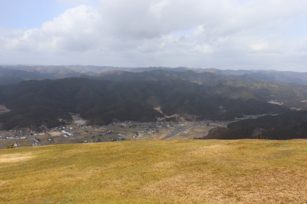
Once we exit the Chanomi-toge Pass, there was the option to take a side trail to Mt.Tendoyama (sign 18, not 15!). It takes about an hour to climb up the mountain, and on the path to the mountain top, there is a para glider take-off area. It’s just about 15 minutes or so from the main route and the view from the para glider take-off area has a magnificent view of Keihoku! Because there are not so many observation spots on the Keihoku Course, we recommend coming up here.
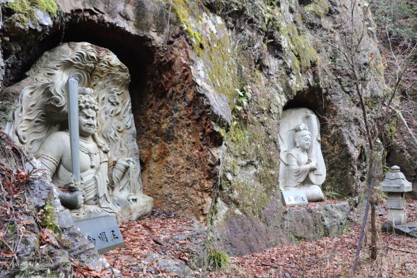
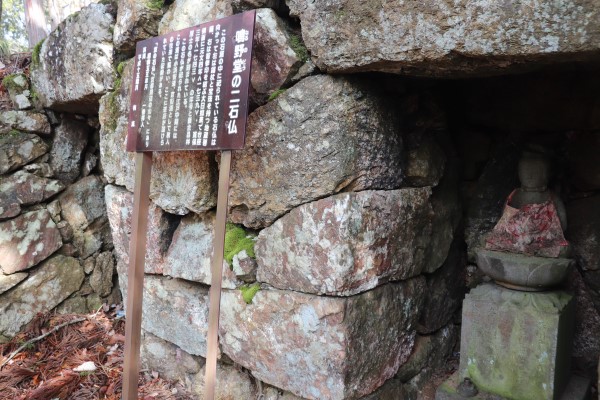
Shortly after we got back on the main trail, we found a little square with two stone Buddha. We decided this was as good enough spot as any to have lunch. It seems this place was once a popular rest area. There was even a tea house nearby because the Saba Kaido that goes from Obama in North Kyoto, passes through here.
After our break, we continued towards Nakae. We were quite surprised to hear gun-fire around here! The sounds come from the Keihoku Shooting Range. We have never seen the shooting range in Japan, so I believe it is one of the very few places in Japan where marksmen can practice for things like the Olympics or target practice.
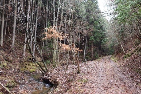
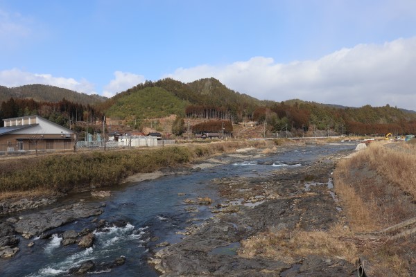
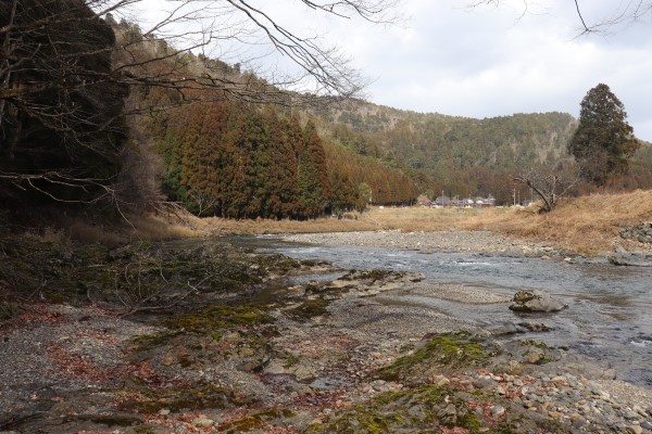
From Nakae, the trail goes along the Kamikatsura River to Joshoo-ji Temple. The trail gets so close to the river that we could walk along the river banks water and really experience just how beautiful the the rivers in Keihoku are. (There is detour route when the river is full.)
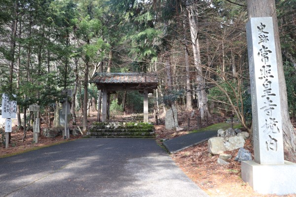
Joshoo-ji Temple is the most popular temple in the Keihoku area, and is well-known for its pretty sakura. During the Nanbokucho Period (the late Kamakura Period), Emperor Kogon decided to become monk and eventually settled in Joshoo-ji Temple. Unfortunately we didn’t have time to drop by this temple…but it looked really pretty!!
Joshoo-ji Temple – Yuge (Tsutsueguchi bus stop)
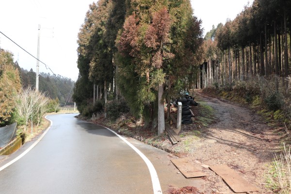
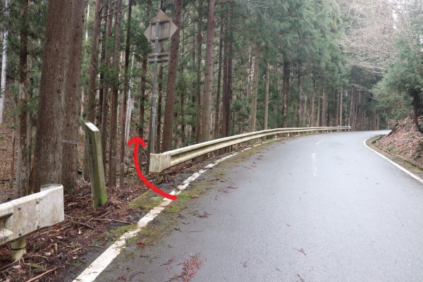
From Joshioo-ji Temple, the trail heads west to Yuge along Prefecture Route 61. While it is possible to walk on the prefecture road all the way to Yuge, the actual trail goes into the woods after a while. It may be hard to find where the trail deviates from Route 61, so be on watch for where the trail splits off. Additionally, at Joshoo-ji Temple is an optional trail that goes east to Kuroda. We didn’t go to that optional trail.
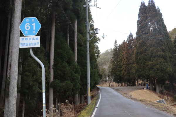
The trail eventually merged with Prefecture Road 61 again.
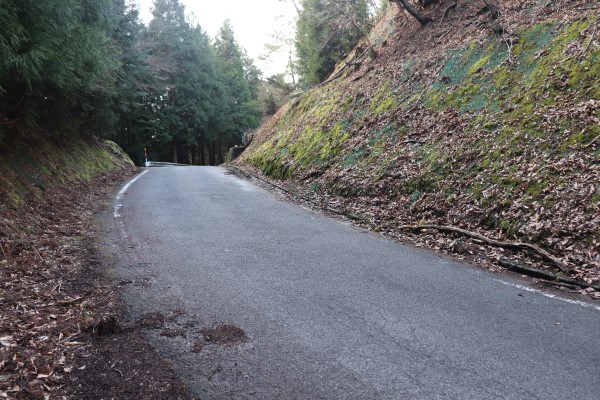
Finally we arrived in Yuge, our last stop on this part of the trail for today. It was comfortable hike with less steep slopes but the trail was a bit rough. We were also quite surprised we didn’t see anybody else on the trail… but it is definitely prettiest and remotest course in Kyoto Circuit Trail!!
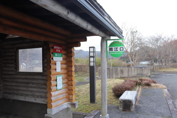
At Yuge, you can take a Keihoku Furusato Bus to Shuzan, then change to a JR bus for central Kyoto. However, the biggest problem with bus service in the Keihoku area is that it is very sparse. In the worst case, you may have to walk to Shuzan. From Yuge to Shuzan it is another 5km along Prefectural Route 162.


Leave a Reply