Nekozaki Peninsula, a geological site with interesting rocks
Nekozaki Peninsula sits quietly at the northern tip of Hyogo Prefecture. At first glance, it seems like an ordinary cape, yet this humble stretch of coast is one of Japan’s most fascinating geological treasures. So much so that it’s part of the UNESCO Global Geopark network, recognized for its rare rock formations and coastal beauty.
Traveler Tip: The coastal trail can be rocky and slippery. Avoid sandals. Sturdy shoes are a must!
Nekozaki Peninsula
Getting to Nekozaki Peninsula
Nekozaki Peninsula is only a 15-minute walk from Takeno Station on the JR San’in Line. It lies at the far western end of Takeno Beach, curving into the Sea of Japan. The name Nekozaki literally means “cat cape,” said to resemble a cat lying down.
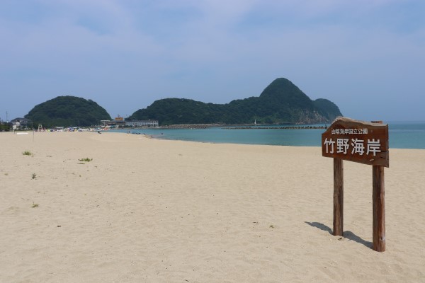
Although it’s called a peninsula, Nekozaki is technically a land-tied island. Over centuries, sand carried by the Takeno River built up and formed a natural bridge connecting it to the mainland. That sandy link is now Takeno Beach, one of Hyogo’s most beautiful seaside destinations.
While the beach is popular in summer, only a few travelers continue onward to explore the Nekozaki Peninsula itself—a hidden adventure beyond the crowds.

Hiking to the Nekozaki Lighthouse
A scenic trail starts from Takeno Kashima Park and stretches about two kilometers to Nekozaki Lighthouse, the northernmost point of the cape. The path climbs gently over Mt. Kashima, a small 150-meter-high hill covered in sea pines.


The walk takes around one hour. Along the way, you’ll enjoy peaceful ocean views and the refreshing scent of the sea breeze. From the summit, the Sea of Japan spreads endlessly, its deep blue waters glinting under the sun.


The Coastal Trail: Where the Earth Tells Its Story
For many, the real highlight of Nekozaki Peninsula isn’t the lighthouse trail—it’s the coastal path. To find it, go down the small staircase next to the diving center at the far end of the park’s parking lot.
You’ll reach a narrow, half-broken trail that hugs the rocky shoreline for about one kilometer. Along the way, the rocks reveal fascinating patterns of strata, fault lines, and even fossilized elephant footprints. Every cliff and crevice tells a silent story of time and tide, shaped by the relentless waves of the Sea of Japan.

Within Kansai, Nekozaki Peninsula and its surrounding San’in Geopark stand alone as the region’s only UNESCO Global Geopark, a must-visit for nature lovers and geology enthusiasts alike.

A Landscape Shaped by Millions of Years
The southern side of the peninsula showcases tuff layers formed about 20 million years ago, overlaid by rhyolite created roughly 3 million years ago. Because tuff erodes easily, the rough waves have carved the rocks into fascinating shapes—arches, notches, and natural sculptures.


Look closer at the wave-cut platforms, and you’ll find potholes—perfectly round holes made when small stones spin in the surf, grinding into the rock below. Some are so symmetrical they seem man-made, like the bases of ancient columns. Peek into them, and you might see small crabs or fish hiding inside.


Journey’s End
The coastal path eventually ends before reaching the lighthouse, but the finale is breathtaking. Here, columnar jointing rises like a wall of basalt pillars, and the sea below glows a vivid cobalt blue. Few people make it this far, yet it feels like a secret corner of the world—wild, quiet, and deeply beautiful.


If you love geology, sea views, and hidden trails, Nekozaki Peninsula is worth every step.


Leave a Reply