Kaido: Japan’s Historic Roads
In the old days, when there were no trains or cars, people walked Kaido to get between towns. Of course, few people nowadays travel on foot, but in many parts of the Kansai region, there exists still many Kaido, and walking on them provides an opportunity to learn about the unique history and culture of the area.
What are Kaido?
Kaido are ancient roads that connect cities. Kaido have existed ever since the earliest days of Japan. People walked on Kaido to transport goods and travel. In the Edo Period these highways began to be developed in earnest. Since the Edo shogunate was required to come to Edo every other year, Kaido leading to Edo from various parts of Japan were developed.
Among them, the Tokaido, the Nakasendo, the Nikko-dochu, Koshu-dochu and the Oshu-dochu, are called Gokaido. Those Kaido were considered most important, thus administered by the government. The other small Kaido called wakikaido or wakiokan and were administered by the regional governments.
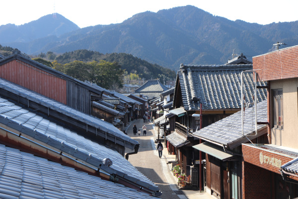
Also, this Kaido made it possible for common people to travel safely between cities. In Tokaidochu Hizakurige, written in the early 19th century, two guys, Yaji and Kita traveled all the way from Tokyo to Ise via the Ise Kaido and Tokaido. This book prompted many people to visit Ise on foot.
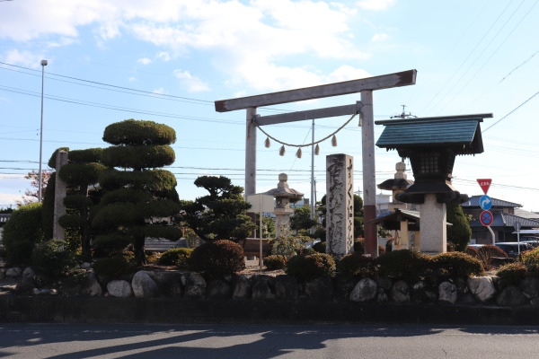
Of course, few people walk those Kaido all the way, and thus the town has changed a lot since old times, but still in many parts, Kaido still does exist with plenty of historic houses with old stone markers and lanterns standing on the way.
Walking Kaido
One may wonder how Kaido is different from other routes and what is so special about it. So here are some things that characterizes old Kaido.
1. Narrow Road and Old Houses
Kaido is barely wide enough for one car to pass. In the old days, Kaido was about 7m wide, and in some big cities, it was 8m wide. However, compared to the modern roads, they are still quite narrow.
Also, Kaido is very straight; you don’t have to make a turn almost at all. This is because Kaido was often used as the main road before the national routes were built
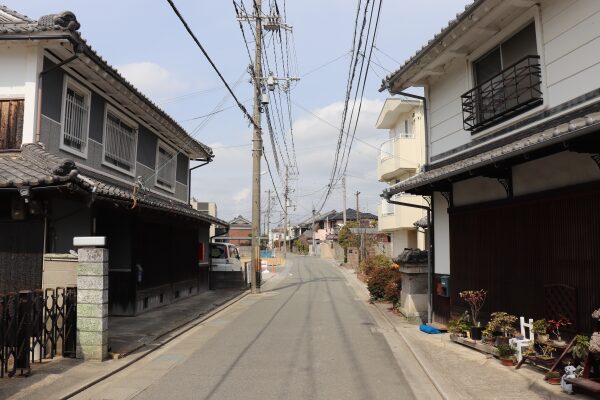
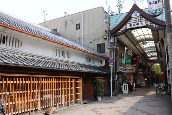
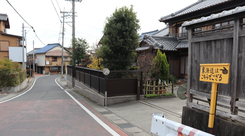
In addition, on the either side of the Kaido stand old houses. Even in urban areas, it is common to see old houses lined up, maintaining the atmosphere of the old days.
Old houses on the street look like two-story buildings, but the second floor is extremely small and used for storage so that the people in the house will not look down on the lord passing Kaido from above.
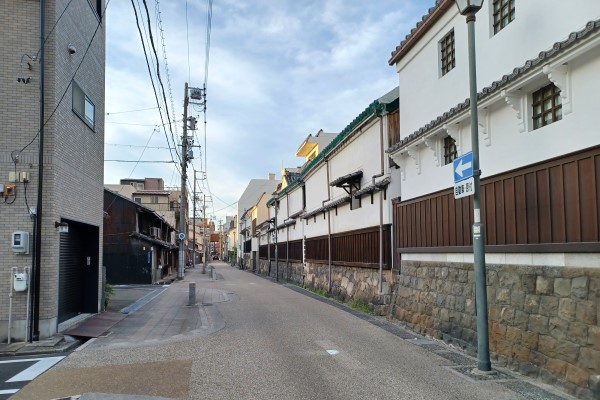
2. Post Town (Shukuba) and Honjin
Some roads are short enough to be walked in a day, while others are extremely long, some more than 500 kilometers long. Along these long roads, post towns, or Shukuba, were built.
At the center of the post town is a Honjin, where feudal lords stayed. When Honjin could not be used for some reason, Waki-honjin was used. These were typically the homes of the local influential people, some of which still exist today, and they are large in size whencompared to the surrounding houses.
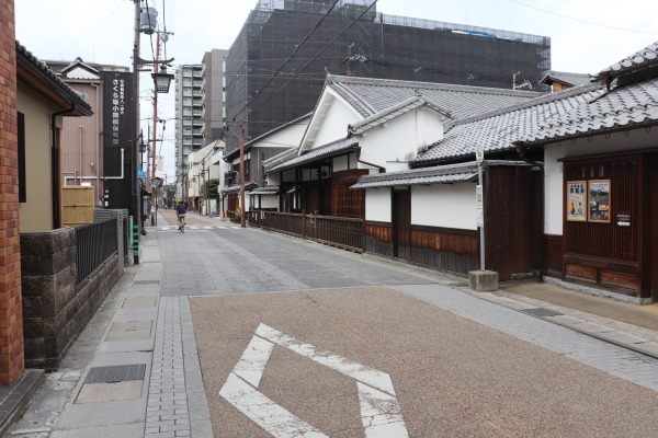
However, as the number of people walking along the highways increased, inns, or hatago, were built to accommodate travelers. While hatago usually provided food, cheaper inns without food, called kichin yado, were built too.
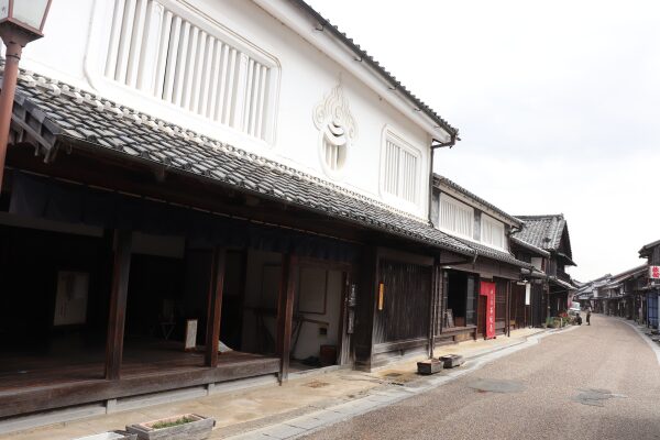
Gradually, merchants who dealt with travelers moved to the post towns, which gradually became more and more prosperous, leading to the large cities we know today.
3. Toro and Stone marker
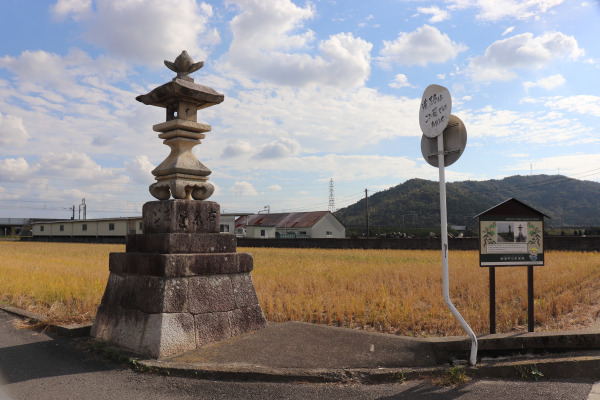
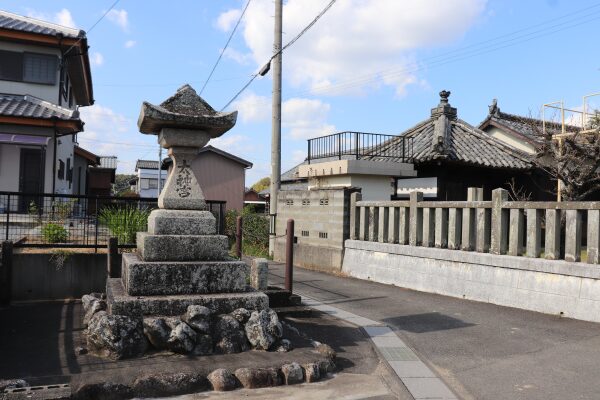
The intersection of a Kaido is called oiwake. These intersections have always stone markers to indicate which city they lead to. Although many of them have been removed because they obstructed the way, these road signs are considered very important in the Kansai region.
Many of the stone markers are more than 100 years old since they were made. There are many different types of wayfinding signs, ranging in size from small to huge.
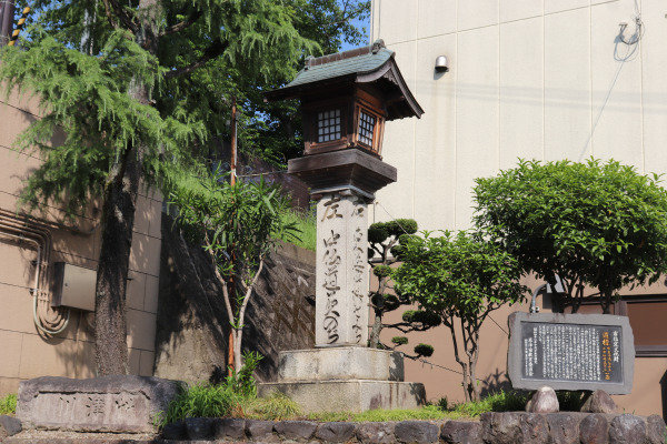
Another symbol of Kaido is stone lanterns called joyato. In the old days, these lamps were lit by fire and used to illuminate the road like streetlights do today. Many of those lanterns are really old and local people preserve them as local treasures.
4. Milestones (Ichirizuka)
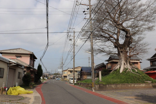
Milestones were built to mark every 4km. A mound was built and a large tree was planted on top of it as a landmark, which is why it is called ichirizuka, a mile mound. Originally, they were built on both sides of the road.
They were used in various ways, such as to rest under the shade of a tree or as a guide for the fare of horse rides and baskets.
Unfortunately, there are very few places where these mounds still exist, as they have been dismantled when modern roads were widened or the trees on top of it have died.
Kaido in West Japan and Kansai
Here are some Kaido in the Kansai region. All Kaido on this list are ones we already walked or are planning to walk.
| Kaido in West Japan | |||
| Name | Route | length (km) | Memo |
| Ise Kaido | Yokkaichi-Shiroko-Tsu-Matsusaka-Ise | 70 | The popular trail for Ise Pilgrimage. |
| Ise-hon Kaido | Sakurai-Hasedara-Haibara-Yamakaasu-Okitsu-Taki-Ise | 100 | The popular trail for Ise Pilgrimage. |
| Izumo Kaido | Himeji-Tsuyama-Maniwa-Neu-Matsue | 200 | Connecting Sanin and Sanyo, going through deep in the mountains. |
| Kishu Kaido | Osaka-Sakai-Kishiwada-Izumiotsu-Izumisano | 50 | Crosses Senshu region of Osaka. Mostly residential areas. |
| Hokkoku Kaido (Hokuriku) | Maibara-Nagahama-Hukui-Kanzawa-Toyama-Niigata | 500 | The main Kaido in Hokuriku Region. |
| Kyo Kaido | Yamashina-Hachiman-Hirakata-Moriguchi-Osaka | 50 | The main Kaido that connects Kyoto and Osaka. It is considered a part of Tokaido. |
| Kumano Kaido | Osaka-Fuchu-Kainan-Yuasa-Gobo-Tanabe-Kumano | 300 | From Osaka to Tanabe is called Kiiji, and from Tanabe, Oheji, and Nakaheji is available to Kumano |
Nara Kaido (Kuragarigoe) | Osaka-Ikoma-Nara | 50 | The shortest way connecting Nara and Osaka, but very steep around the pass. |
| Koya Kaido | Kawachinagano-Hashimoto-Kamuro-Koyasan | 30 | Also known as Kyo-Osaka michi, a popular hiking course to Koyasan. |
| Sasayama Kaido | Kameoka-Sasayama-Wadayama | 100 | A shortcut to the Sanin region via Tamba Sasayama. |
| Saba Kaido | Obama-Kutsuki- Ohara-Demachiyanagi-Kyoto | 100 | Kaido used to carry mackerel (saba) from Obama to Kyoto. |
| Saigoku Kaido | Kyoto-Ibaraki-Nishinomiya-Kobe-Himeji-Okayama-Hiroshima-Shoimonoseki | 600 | The main Kaido in west Japan, going along JR Sanyo Line. |
| Takenouchi Kaido | Sakai-Furuichi-Nagao | 3 | One of the oldest Kaido in Japan. It further leads to Yokooji and then Ise Kaido in Sakurai. |
Nara Kaido (tatsutagoe) | Osaka-Yao-Kashiwara-Ikaruga-Nara | 50 | Another Kaido connecting Osaka and Nara. It goes along JR Yamatoji Line. |
| Chugoku Kaido | Osaka-Amagasaki-Nishinomiya | 20 | Kaido from Osaka City leading to Saigoku Kaido in Nishinomiya |
| Tokaido | Kyoto-Kusatsu-Kameyama-Yokkaichi-Shizuoka-Hakone-Tokyo | 500 | The most popular Kaido in Japan. It goes along the ocean side. |
| Nagasaki Kaido | Kokura-Kurosaki-Dazaifu-Saga-Nagasaki | 200 | Very popular, and important Kaido in Kyushu. |
| Nakasendo | Kyoto-Kusatsu-Hikone-Sekigahara-Gifu-Suwa-Karuizawa-Tokyo | 500 | One of the most popular Kaido in Japan. It goes in the mountain side. |
| Nara Kaido | Kyoto-Fushimi-Nara | 40 | Kaido connecting Kyoto and Nara. |
| Hase Kaido | Sakurai-Hase-Nabari-Aoyama-Matsusaka | 70 | Another popular road for Ise Pilgrimage. It goes along the Kintetsu Osaka Line. |
| Higashi Koya Kaido | Hachiman-Higashi Osaka-Kashiwara-Kawachi Nagano | 60 | Shortcut to Koyasan from Kyo Kaido. Crossing the Kawachi region in Osaka. |
| Minoji | Nagoya-Kiyosu-Tarui | 60 | Connecting Tokaido and Nakasendo via Nagoya. |
| Yagyu Kaido | Nara-Yagyu-Kasagi | 30 | Popular hiking course. |
| Yamato Kaido | Nara-Kasagi-Iga-Seki | 70 | Leading to Tokaido in Seki. It goes along JR Kansai Line. |
Leave a Reply