Fushimi Fukakusa Route: Kyoto Circuit Trail
The Fushimi–Fukakusa Route of the Kyoto Circuit Trail, an extension of the Higashiyama Course, is a relatively short 9.5-kilometer hike through the southeastern part of Kyoto. Despite its length, the route offers a wide variety of attractions, from beautiful natural scenery to historic sites, making it an excellent choice for a day hike.
Fushimi Fukakusa Route
Fushimi
The Fushimi–Fukakusa Route begins at Fushimi-Momoyama Station on the Keihan Line, about 15–30 minutes from central Kyoto.
Fushimi-Momoyama was once a castle town that developed around Fushimi Castle. Today, however, Fushimi is best known for its sake brewing industry. Along with Nada in Hyogo Prefecture, it is one of western Japan’s most renowned sake-producing areas, and visitors will find plenty of opportunities to sample local sake.
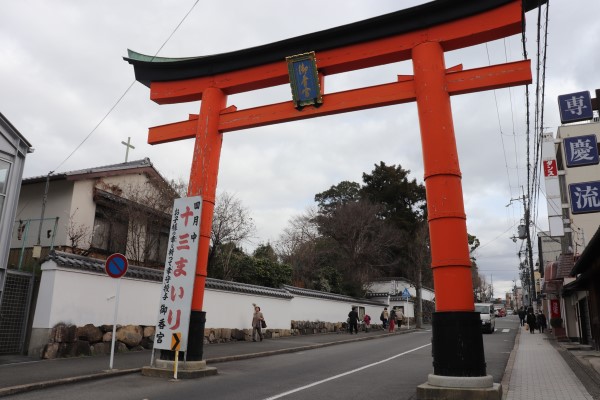
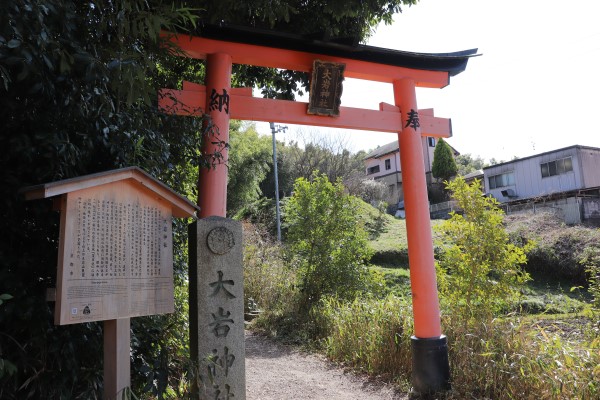
From the station, the trail follows the main road uphill and passes directly in front of Gokōgū Shrine, one of the most important and well-known shrines in Fushimi.
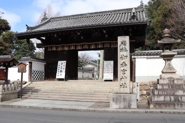
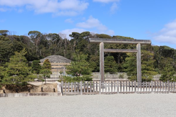
After crossing the Kintetsu Line and the JR Nara Line, you’ll come to the Mausoleum of Emperor Meiji. Nearby stands Nogi Shrine.
The shrine is dedicated to General Nogi Maresuke, one of the most prominent military figures of the Meiji era. Deeply devoted to Emperor Meiji, Nogi and his wife took their own lives following the emperor’s death in 1912.
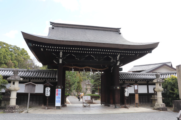
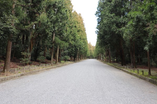
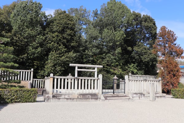
Fushimi Fukakusa trail passes just in front of the Mausoleum of Emperor Meiji. Although the route continues straight ahead, a short detour up the path to the right offers a clear view of the mausoleum.
Kyoto is home to several imperial mausoleums, but the Mausoleum of Emperor Meiji is particularly impressive in scale.
As with most imperial mausoleums in Japan, visitors are not permitted to enter the burial grounds. Even still, it’s worth taking the short detour. The approach is quiet and peaceful, and it’s easy to get a sense of just how large the mausoleum is.
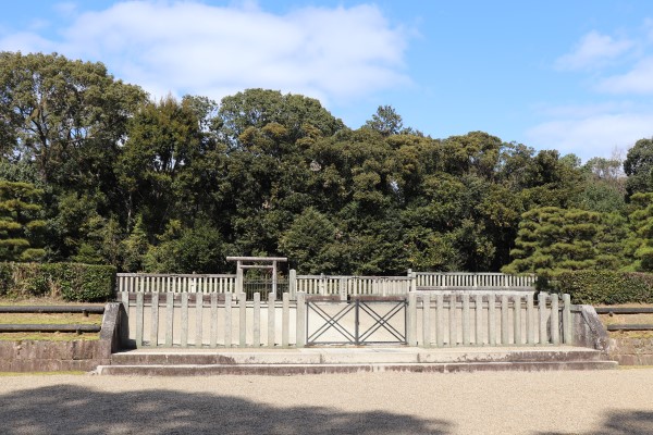
Near the Mausoleum of Emperor Meiji stands the Mausoleum of Emperor Kanmu. Although it is much smaller in scale, Emperor Kanmu played an equally important role in Japanese history. While Emperor Meiji moved the capital from Kyoto to Tokyo, Emperor Kanmu was the emperor who transferred the capital from Nara to Kyoto over a thousand years earlier.
For that reason, Emperor Kanmu remains a particularly important figure in Kyoto’s history and is still held in high regard by many people in the city.
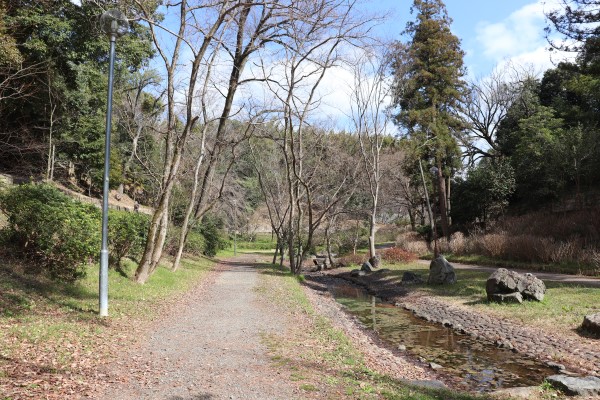
Fushimi Momoyama Park
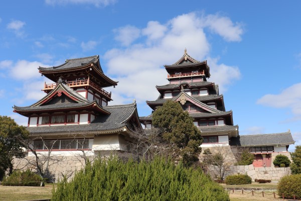
From the Mausoleum of Emperor Kanmu, the trail passes through Fushimi-Momoyama Park. Standing in the park is a castle keep associated with Fushimi Castle. However, it is a modern reconstruction and does not accurately reflect the appearance of the original castle. In fact, it is not even located on the original site of Fushimi Castle.
So why is it here? The answer lies in a former amusement park called Fushimi Castle Land. The reconstructed keep served as the park’s main attraction. Although the amusement park closed in 2003, the keep remains and has become a familiar landmark in the area.
The main keep stands 50 meters tall, with a smaller 30-meter keep beside it. Even though it’s only a reconstruction, the scale is impressive. Unfortunately, visitors can no longer enter the building because it does not meet current earthquake-safety standards.
To Mt. Oiwa
Shortly after leaving Fushimi-Momoyama Park, the trail begins climbing Mt. Oiwa. At just 182 meters above sea level, it is not a particularly demanding ascent, and most of the route follows paved roads.
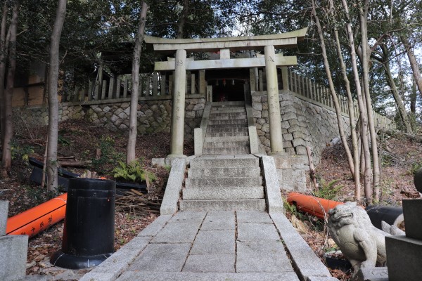
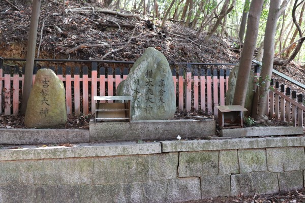
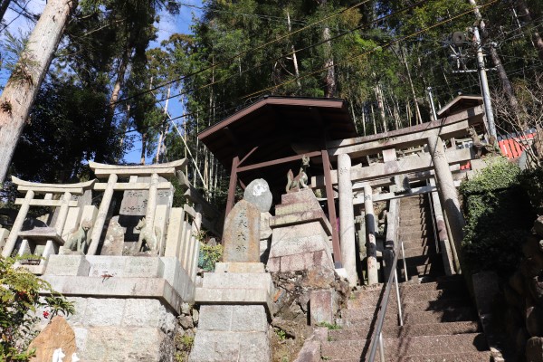
Together with nearby Mt. Inari, Mt. Oiwa has long been an important center of Inari Faith. Scattered across the mountain are numerous otsuka, small stone mounds dedicated to private Inari deities and erected by individual worshippers or organizations.
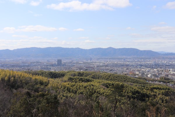
At the summit, an observation deck offers sweeping views over Kyoto City, making it a rewarding stop along the route.
Oiwa Shrine sits at the top of the mountain, but it appears to be somewhat neglected today. It may have once been one of the many Inari shrines that flourished during the period when Inari worship was especially popular.
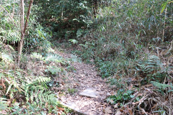
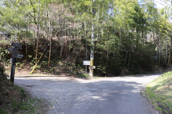
While the route up the mountain is entirely paved, the descent follows an unpaved trail through the forest. Thanks to the efforts of local people, the path is generally well maintained, although some sections can become quite overgrown, especially during the summer months.
Coming down from Mt. Oiwa, the trail passes by the Mausoleum of Emperor Ninmyo.
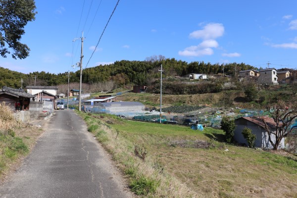
Although it is not marked on the route, this section of the trail actually follows the historic Kyo Kaido road. The Kyo Kaido branches off from the Tokaido in Yamashina and once served as an important route connecting Kyoto and Osaka.
Today, it may not feel particularly historic as it runs through a residential area, but during the Edo period, the Kyo Kaido was one of the main routes used for travel between Tokyo and Osaka.
To Fushimi Inari Shrine
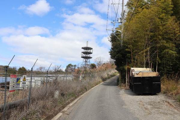
After passing under the Meishin Expressway, the trail begins climbing toward Mt. Inari. At this point, we were already close to the end of today’s hike.
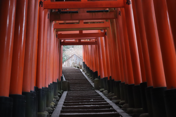
Along the way, we came across a sign pointing toward Ichino Torii, which stands near the summit of Mt. Inari. Most visitors climb Mt. Inari via the main route through Okunoin, but if you look closely at the map, you’ll notice that there are actually several paths leading to the top.
One thing to keep in mind is that the Fushimi-Fukakusa Route itself does not go all the way to the summit of Mt. Inari.
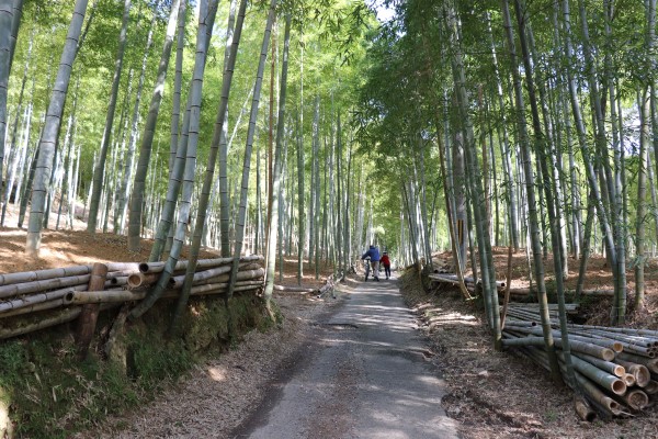
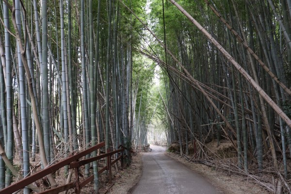
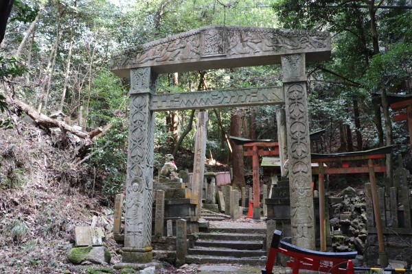
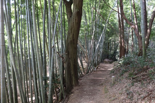
On the way to Fushimi Inari Shrine, the trail passes through a bamboo forest and several small shrines.
Because this area is close to Mt. Inari, you’ll find many otsuka and waterfalls used for religious practices by Inari worshippers. Some of these places have signs asking visitors not to take photos, as they are considered sacred sites.
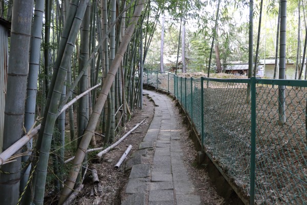
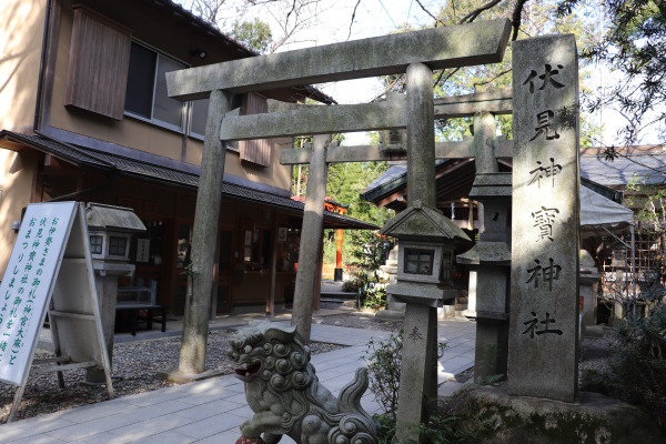
After passing through the beautiful bamboo forest, the trail reaches Fushimi Kandakara Shrine and finally Fushimi Inari Shrine, the end point of the route.
And that brings us to the end of the Fushimi–Fukakusa Route. It is a relatively short half-day hike, but it can easily become a full-day adventure if you continue exploring Mt. Inari.
The trail passes close to Okunomiya of Fushimi Inari Shrine, and the Higashiyama Course of the Kyoto Circuit Trail begins just beyond this point.
If you are ready to finish your hike, the main shrine buildings of Fushimi Inari Shrine are only about a 5-minute walk away!


Leave a Reply