Kyoto Isshu Trail: Kyoto’s Great Nature Trail
Kyoto City is prized for not just the beauty of its man-made structures but, its natural beauty as well. It is easy to forget, but Kyoto City is surrounded by mountains and deep forests! In fact, there is even a well maintained trail that goes through those mountains. The Kyoto Isshu Trail goes all around the perimeter of Kyoto and inside some of the city too. This trail is quite long (more than 50 miles!), so you might not be able to complete it all at once, but this is the great way to enjoy the natural of splendor of Kyoto!
Here we include a basic description of each of the trails routes (sometimes called courses), as well as tips about those routes. To read more details about each one, follow the links to the individual posts for even more details.
Kyoto Isshu Trail
Higashiyama Route (24.6km) +Fushimi-Fukakusa Route (9.5km)
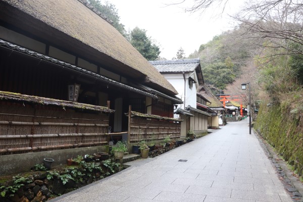
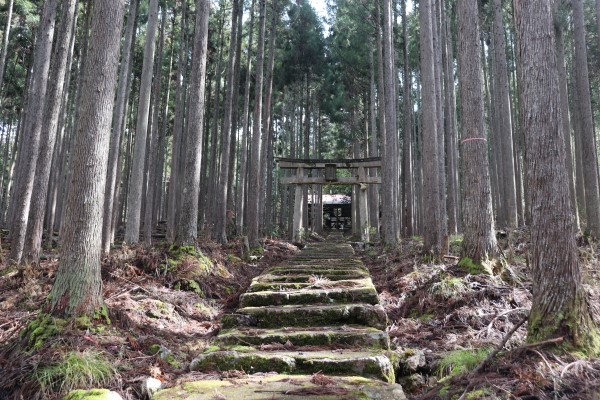
Fushimi Inari Taisha → Sennyu-ji Temple → Mt. Amidagamine → Higashiyama Sancho Park → Keage Station → Mt. Daimonjiyama → Philosopher’s Path → Ginkaku-ji Temple → Mt. Uryuzan → Cable Hiei Station
Estimated Time
8~9 hours for Higashiyama Course + 3 hours for Fushimi Fukakusa Course
Route Description
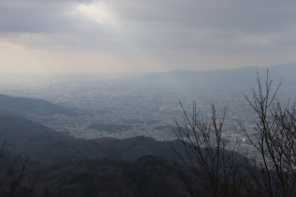
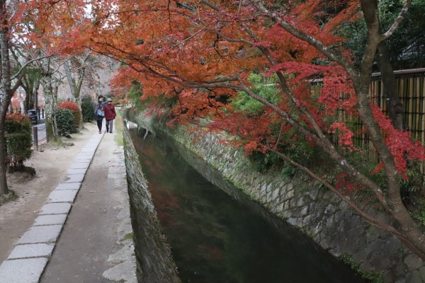
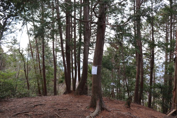
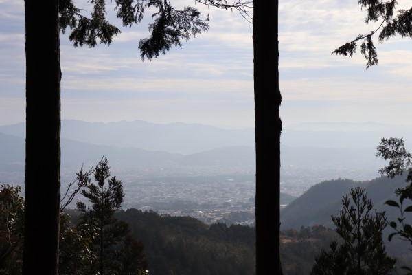
The first half of the trail goes through residential areas, but then gives way to the Higashiyama Mountain chain that even goes up Mt. Daimonjiyama. Along the trail you can see many famous temples, making this the most popular route of the Kyoto Isshu Trail. The second half of this route is pretty steep, because after Ginkaku-ji Temple, it goes up Mt. Hiei.
Higashiyama course has an optional 10km route from Fushimi Station to Fushimi Inari Taisha
Kitayama East Route (18.1km)
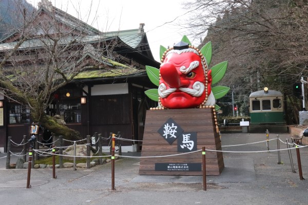
Cable Hiei → Saito → Mt.Yokotakayama → Mt.Mizuiyama → Todera (South Ohara) → Shizuhara → Kurama → Kifuneguchi Station → Ninose Station
Estimated Time
7~8 hours
Route Description
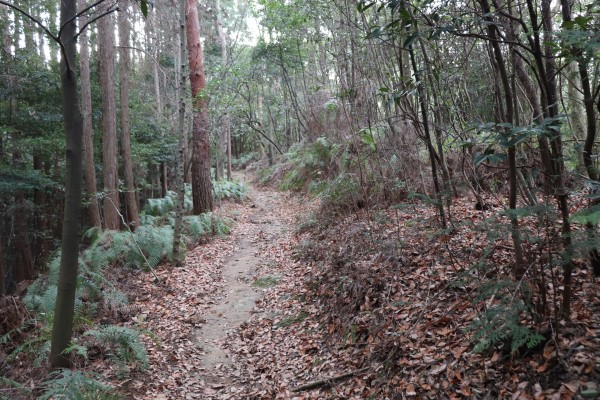
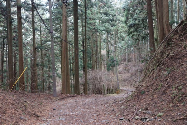
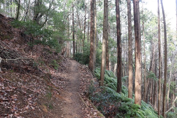
The Kitayama East Course is a beautiful mountain path that goes from Hieizan to Kurama via south Ohara. On this trail, you can enjoy beautiful fall foliage, flowers in spring, and possibly a bit of snow in winter. This course mainly consists of mountain paths, as you go up several mountains. It is also a rather hilly course; full of ups and downs with few stopping points and no nearby comforts like convenience stores.
Kitayama West Route (19.6km)
Ninose Station → Mt.Mukaiyama → Himuro → Sawanoike pond → Takao → Kiyotaki
Estimated Time
7~8 hours
Notes: September 25 – November 10 is matsutake season. If you don’t already know, matsutake is a kind of mushroom that is considered a delicacy. These mushrooms are big business, so during this time period, you have to take a detour which will add an additional hour to your hike.
Route Description
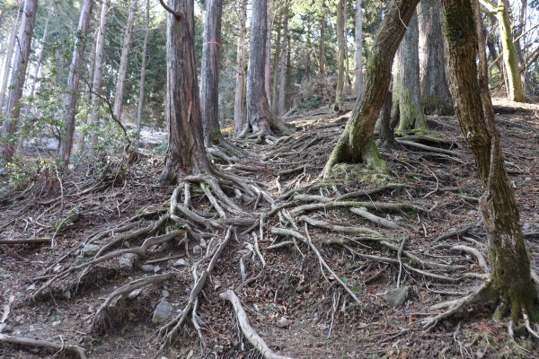
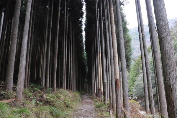
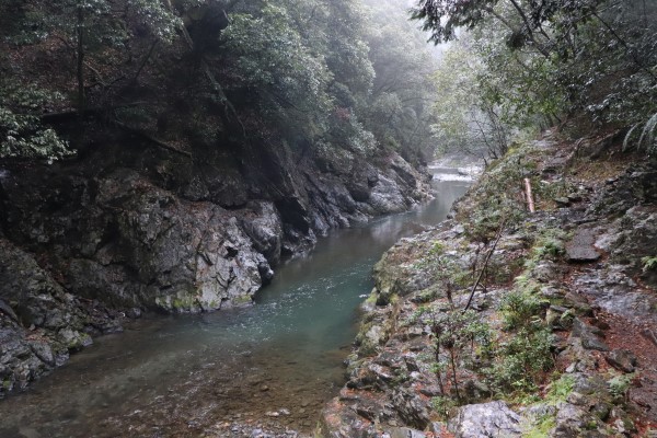
This trail mainly goes deep into the forest around Kyoto; most notably Kyoto’s Kitayama cedar forest. Though things get off to a rather hilly start, things eventually even out after Himuro. After Takao, the route follows the Kiyotaki River and then through several beautiful gorges.
Nishiyama Route (12.3km)
Kiyotaki → Ochiai → Saga Toriimoto → Arashiyama City central area → Mt. Matsuoyama → Kamikatsura Station
Estimated Time
3 hours
Route Description
The Nishiyama Route is one of the most popular trails, as it is the easiest trails of the Kyoto Isshu Trail. After passing through several gorges, it goes through some Arashiyama’s most popular tourist sites like Tenryu-ji and the famous Bamboo Forest. The last leg of the route takes you up Mt. Matsuoyama, but this mountain is only 275m high, and is therefore a really easy climb.
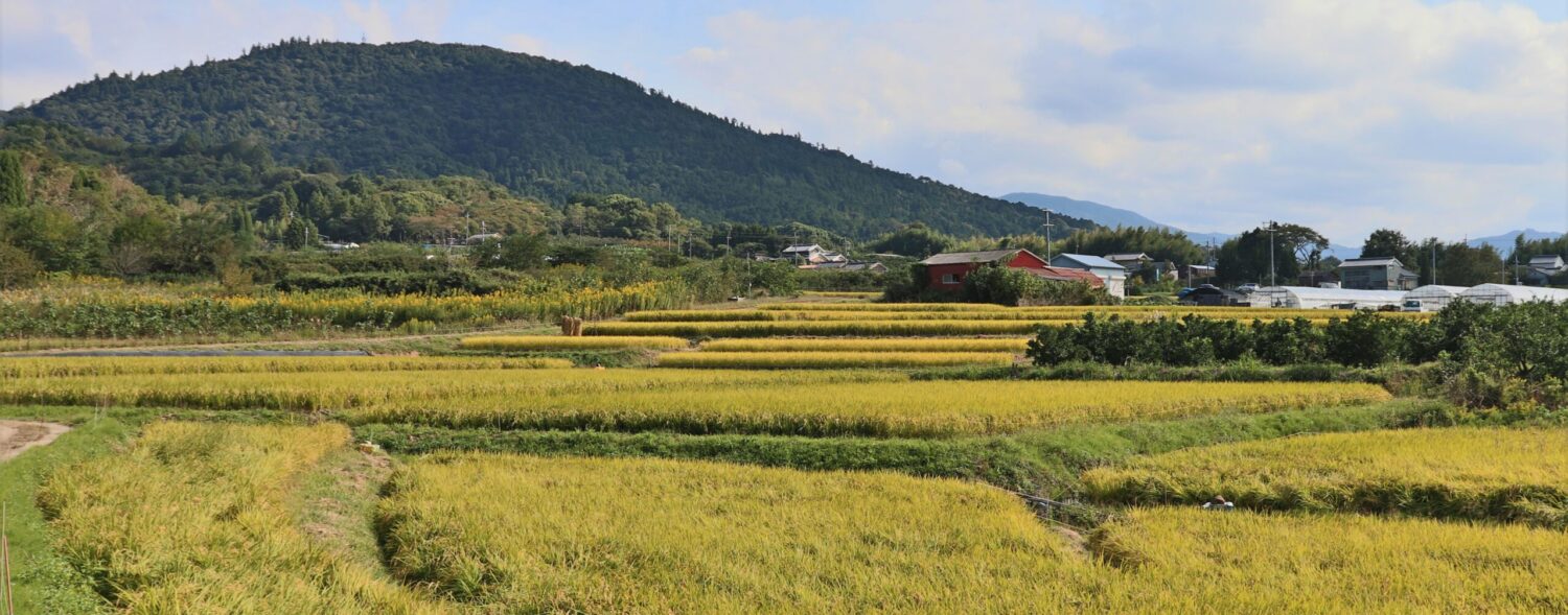
Keihoku Route (34.8km)
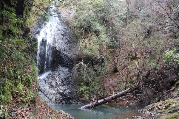
Hosono → Takimatanotaki waterfall → Joshokoji Temple → Kaminakajo Castle Ruins → Mt. Kurooyama → Uogafuchi Suspension Bridge → Hosono
Estimated Time
10-11 hours
Route Description
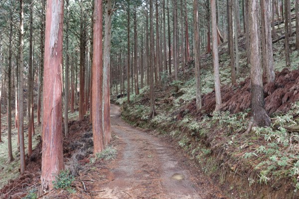
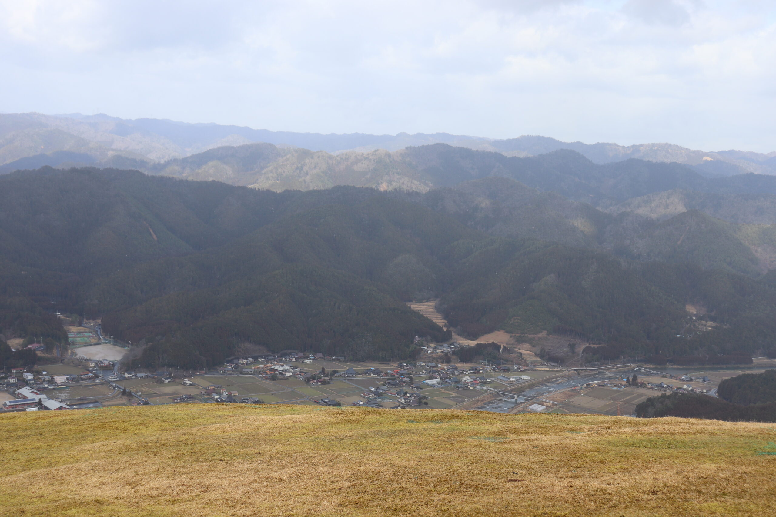
The Keihoku Route is 40km long and goes through the beautiful Kyoto countryside and the Keihoku area, which is located an hour north from central Kyoto City. Also, this trail goes through deep in the forest in Keihoku, it has an abundance of Kitayama cedar trees.
Tips For Walking the Kyoto Isshu Trail
Clear Routes
The great part about the Kyoto Isshu Trail is that there are plenty of signs along the trails. That being said, although almost all major intersections have signs, they are sometimes small or hard to find, so stay alert.
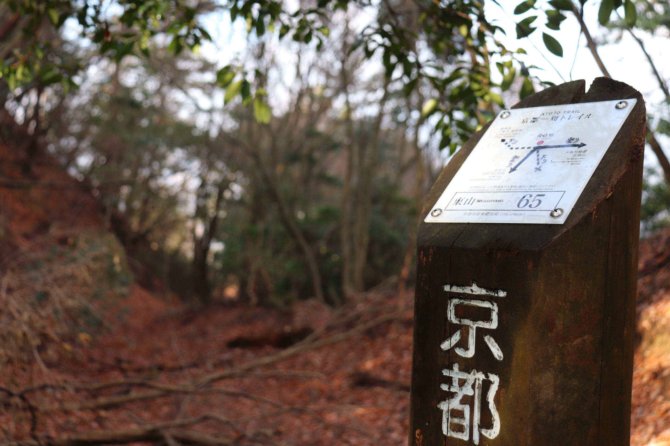
Moreover, the Kyoto Isshu Trail is overall well maintained. Despite the huge typhoon that hit the Kansai region in 2018 resulting in lots of debris and fallen trees, the paths are already clear and nothing blocks the main parts of the trail. As long as you stay on the right route, you don’t have to worry about the condition of the trail.
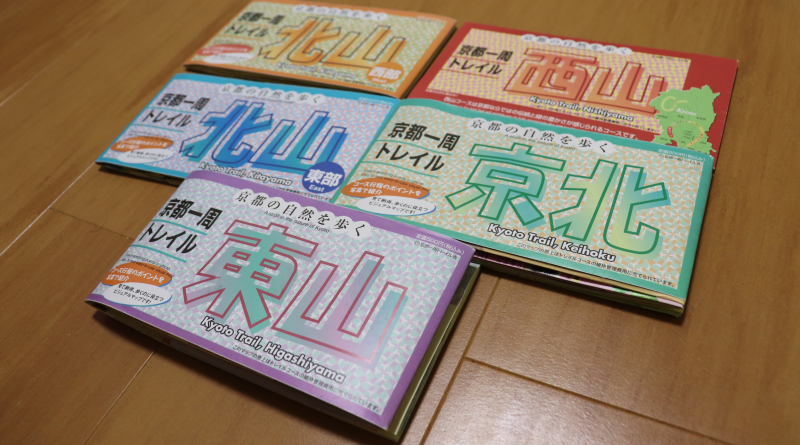
Buy maps
Some of you might think it is a waste of money to buy maps if the trail is well-marked, but we still recommend buying maps of the trail. Not only do they contain details about the individual routes, but also estimated completion times, where all those signs are, as well as additional routes and famous spots. They are very informative, so why not!
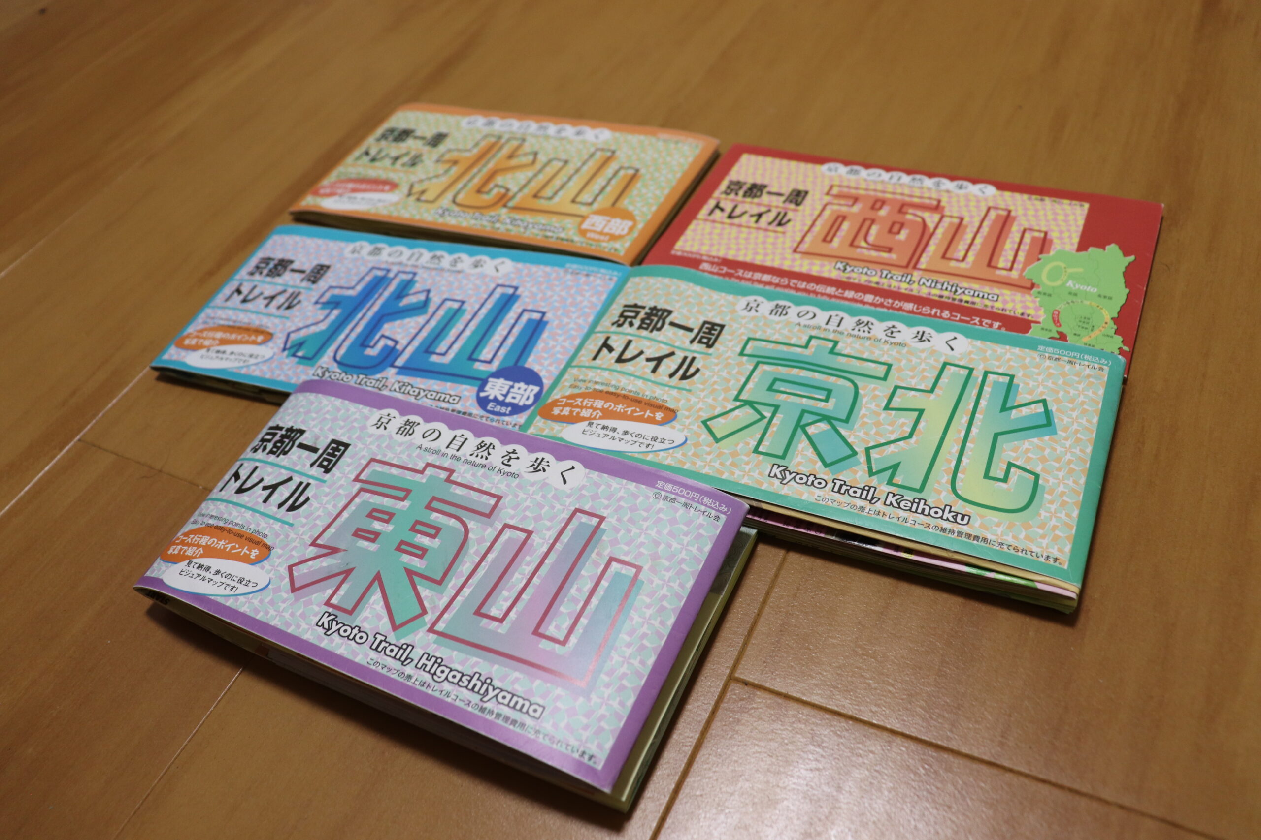
The quality of these maps is really good too, and travel well with you while you are walking. Best of all, each map is only 500 yen.
The only disadvantage is for some reason only a handful of stores sell those maps. Many large bookstores in Kyoto sell them, but otherwise, it is a bit tricky to find them. We bought the maps at Kinokuniya Bookstore in Grand Front in Osaka Station, but even in Osaka they were hard to find.
The Keihoku Course is pretty…but hard to access
Despite being very beautiful, the Keihoku Course is significantly less popular than other parts of the Kyoto Isshu Trail. The main reason for this lack of popularity is simply that it is hard to access the Keihoku Course. Just reaching the start of the Keihoku Course takes an hour from central Kyoto City, and the bus service of the Keihoku area, called Keihoku Furusato Bus, is very limited. It is completely possible that you may just have to walk all the way back to the Shuzan bus stop just to get a bus back to Kyoto City. It is a really pretty place, but quite inconvenient.
Additionally, the Keihoku area has tons of snow in winter (around 10 feet) and while other part of the Kyoto Isshu Trail only report the occasional bears sighting, they are fairly frequently spotted in Keihoku area (some 20-30 sightings in the past few years).
Leave a Reply